





A new passive visual marker technology enables drones to identify specific targets from up to one kilometre without GPS, RF, or network links, expanding autonomous inspection, defence, and infrastructure applications.
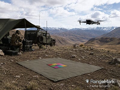
Autonomous drones may soon gain a more reliable way to identify specific objects over long distances without relying on GPS, radio-frequency communication, or network connectivity. Sodyo has introduced RangeMark, a patented visual identification technology that enables drones and other remote systems to detect and decode passive printed markers from distances of up to one kilometre using only onboard cameras.
Unlike conventional computer vision systems that classify objects based on probability, RangeMark is designed to provide deterministic identification. Instead of merely recognising that an object resembles a vehicle, rooftop, or person, the system decodes a unique machine-readable marker attached to the target, allowing autonomous platforms to verify its exact identity. This capability addresses a longstanding challenge in machine vision, where accurate recognition at long distances becomes increasingly difficult despite advances in AI-based detection.
The technology employs passive printed markers that require neither batteries nor active electronic components. Since the markers emit no radio signals and need no GPS, cellular, or wireless infrastructure, they can be deployed in environments where communication networks are unavailable, unreliable, or intentionally denied. The company states that the system has demonstrated detection of a one-metre marker at distances up to 500m and a 50cm marker at 250m during flight tests, while its architecture is designed to support detection ranges extending to one kilometre under suitable conditions.
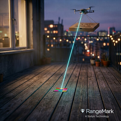
RangeMark also supports drone operations during hovering, transit, and search-pattern flights at speeds reaching 20m/s. According to the company, the technology can scan a camera field of view covering nearly 200,000sqm, enabling rapid identification of marked assets across large operational areas. The platform currently supports visible-light colour markers and duo-tone carbon markers for challenging visibility conditions, with additional spectral variants under development.
Potential applications include defence target verification, critical infrastructure inspection, warehouse automation, smart-city asset management, search-and-rescue missions, and industrial site monitoring, where autonomous systems must distinguish one specific object from many visually similar ones. Because the identification relies solely on optical imaging and passive markers, the approach could simplify deployment while reducing dependence on external positioning or communication infrastructure. The technology is protected by more than 35 patents dating back to 2012 and will be commercialised through licensing partnerships with drone manufacturers, autonomy platform developers, camera vendors, and system integrators.


