


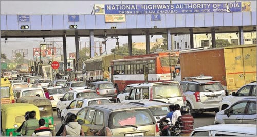
Ever-increasing traffic flow leads to traffic congestions and jams, giving rise to increase in the cost of transportation as well as affecting the routine lives of people. An intelligent traffic management system enables users to be better informed and to make safer, more coordinated, efficient and smarter use of transport networks.
An intelligent traffic management system (ITMS) is defined as an advanced application that—without embodying intelligence as such—aims to provide innovative services related to different modes of transport and traffic management. It enables users to be better informed and to make safer, more coordinated, efficient and smarter use of transport networks.
In ITMS, communication and information technologies are applied in the field of road transport, road infrastructure, vehicles, users and traffic management. ITMS provides a useful interface with other modes of transport to improve the efficiency of road transport and traffic management.
Interest in ITMS is growing rapidly due to increasing concerns related to internal security, as ITMS includes surveillance of roadways, which is an important requirement in the field of internal security. ITMS is playing a major role in providing an effective and efficient means of rapid mass evacuation of people in such situations as natural disasters, fires, riots or terrorist attacks.
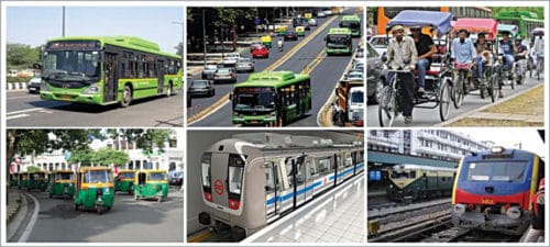
In developing countries such as ours, migration from rural to urbanised habitats due to rapid urbanisation and industrialisation is causing high population density without significant infrastructural development of the suburbs. Mega cities, such as New Delhi and Mumbai, are affected the most. Use of multimodal transportation systems, including bicycles, motorcycles, auto rickshaws, cars, buses, metro, trains and pedestrians, are leading to rapid increase in road traffic.
This ever-increasing traffic flow leads to traffic congestions and jams, giving rise to increase in the cost of transportation as well as affecting the routine lives of people. It is causing several problems such as wastage of fuel and time, increasing environmental pollution, accidents and cases of road rage.
There are several other reasons causing this sudden surge in road traffic, including rise in population (leading to an increase in the number of vehicles on road), insufficient road capacity, traffic control lights (that are not as per traffic density), non-availability of complete and timely information regarding traffic density on different routes, inefficient transport management and unrestrained demand for vehicles. Given this situation, the very nature of traffic makes it difficult to estimate the road traffic density on real-time basis, so as to make better traffic-related decisions and manage the traffic efficiently.
As a result, cities are unable to cope up with these problems. While the emphasis is on building roads, bridges and underpasses, and creating alternative modes of mass public transport systems, this is not sufficient to address traffic congestion and management, which continues to become more difficult with every passing day. Hence, there is an urgent need for introducing a modern system for resolving these issues.
The solution lies in leveraging advanced technologies and intelligent solutions by deploying ITMS. This system would be able to track the flow and pace of traffic to provide real-time traffic management, which is more dynamic and accommodative of the varying nature of traffic density.
Technologies used for ITMS
A number of technologies, described below, are integrated to build ITMS. The technologies need to be chosen depending on use, location and finances available. Advances in the field of telecommunications and information technology coupled with availability of ultramodern and state-of-the-art microchips, radio frequency identification (RFID) and inexpensive intelligent beacon-sensing technologies are helping enhance the technical capabilities of these systems.
Communication technologies
Among the wireless communication technologies used for ITMS, radio communication using UHF and VHF are the most popular ones for short-range communication.
Longer-range communications use infrastructure networks such as Worldwide
Interoperability for Microwave Access (WiMAX), Global System for Mobile Communications (GSM) or 3G.
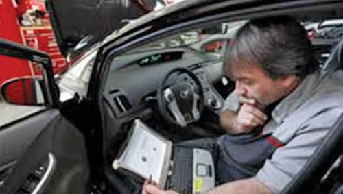
Technologies for automotive electronic systems
These systems are used in vehicles for engine management, ignition, radio, computer-on-board (carputers), telematics, in-car entertainment, navigation and related elements of other control systems.
Automotive electronic systems could also include advanced driver-assistance systems like lane-assist, speed-assist, blind spot detection, park-assist, adaptive cruise control, pre-collision assist and so on.
Recent advances in hardware memory management and real-time operating systems have made it possible to use fewer and more capable computer microprocessors as a part of in-vehicle automotive electronic systems. A typical vehicle in the early 2000s had non-real-time microprocessor-based operating systems, whereas the new embedded system platforms include far more sophisticated networks and software applications, artificial intelligence (AI) and ubiquitous computing.
Technologies for traffic measurement. Various technologies are available to obtain raw data for traffic measurement. Data from different methods can be combined in intelligent ways to determine the state of the traffic accurately. A data-fusion-based approach that utilises road-side-collected acoustics, image and sensor data bring together the advantages of different individual methods.
Normally, cameras are used; however, today, modern, faster and more reliable methods using sensors are available for traffic measurement. These are less expensive than cameras, provide more coverage (potentially including all locations and streets), are faster to set up, need less maintenance and work in all weather conditions, including heavy rain.
Video vehicle-detection system
Traffic-flow measurement and automatic incident detection using video cameras is the most popular form of vehicle detection. Cameras are mounted on poles or structures above or adjacent to roadways. This is a non-intrusive method of traffic detection, since it does not involve installing any components directly into the road surface or roadbed.
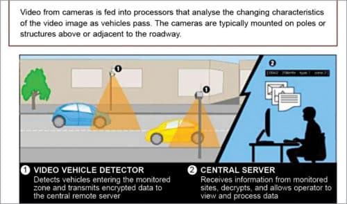
Video footage from the cameras is fed to processors, which analyse the changing characteristics of the video images as vehicles pass by. A single video-detection processor can detect traffic from one to eight cameras, simultaneously. The system requires some initial configuration to familiarise the processor with the baseline background image by feeding known measurements such as distance between lane lines or height of camera above the roadway as input. Output from a video vehicle-detection system includes lane-by-lane vehicle speeds, counts and lane-occupancy readings. Some systems can also provide additional outputs such as gaps, headway, stopped-vehicle detection and wrong-way vehicle alarms.
Audio vehicle-detection system
Traffic density can also be measured using the audio signal that consists of cumulative sounds from tyre noise, engine noise, engine-idling noise, honks and air turbulence noise.
A roadside-installed microphone picks up the audio that comprises various vehicle noise, and audio-signal-processing techniques are applied to estimate the state of traffic. Accuracy of such a system compares well with other methods.
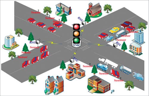
Sensing systems
Sensing systems are vehicle- and infrastructure-based networked systems. Infrastructure sensors are indestructible, such as in-road reflector devices that are installed or embedded in the road or at road sides. Vehicle-sensing systems deploy infrastructure-to-vehicle and vehicle-to-infrastructure electronic beacons for identification communications. These may also employ video automatic number-plate-recognition or vehicle magnetic-signature-detection technologies at intervals to increase sustained monitoring of vehicles in critical zones.
Inductive loops are placed in a roadbed to detect vehicles as these pass through the loop’s magnetic field. The simplest detectors simply count the number of vehicles during a unit of time that pass over the loop, while more sophisticated sensors estimate the speed, length and class of vehicles, and the distance between these. Loops can be placed in a single lane or across multiple lanes. These work with very slow or stopped vehicles, as well as vehicles moving at high speed.
Systems based on cellphones
These days a high proportion of vehicles contain one or more cellphones that periodically transmit their presence information to the cellphone networks, even when no voice connection is established. As a vehicle moves, so does the signal of the cellphones. By measuring and analysing network data using triangulation, pattern matching or cell-sector statistics, this data can be converted into traffic flow information.
The advantage of this method is that no additional infrastructure needs to be built along the road as the existing cellphone networks are used. However, the method could be complicated in areas where the same cellphone tower serves two or more parallel routes.
Vehicle re-identification
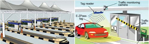
This method requires sets of detectors mounted along the road. In this technique, a unique serial number on the number plate of the vehicle is detected at one location and then detected again (re-identified) further down the road. Travel time and speed are calculated by comparing the time at which the vehicle is detected by the pairs of sensors. This can be done using Bluetooth, RFID or serial numbers from electronic toll collection (ETC) transponders (also called toll tags).
GPS-based method
An increasing number of vehicles are now equipped with in-vehicle GPS or satnav (satellite navigation) systems that have two-way communication with a traffic data provider.
Different position readings from these vehicles are used to compute vehicle speeds.
Smartphone-based monitoring
Smartphones with sensors are used to track traffic speed and density. Accelerometer data from smartphones used by car drivers is monitored to find out the traffic speed and road quality. Audio data and GPS tagging of smartphones enable identification of traffic density and possible traffic jams.
Bluetooth detection
Sensing devices implanted along the road are used to detect Bluetooth devices present in passing vehicles. By interconnecting these sensors, it is possible to calculate travel time and provide data for origin and destination matrices. This is an accurate and inexpensive way to measure travel time, and make origin and destination analysis.
Compared to other traffic measurement technologies, Bluetooth measurements have the advantages of being more accurate and non-intrusive. This leads to lower-cost installations for both permanent and temporary sites, which are generally quick to set up with little calibration requirements. In this method, counting and other applications are limited by the number of Bluetooth devices broadcasting in a vehicle.
Uses and applications
Automatic road enforcement
ITMS provides an effective traffic-enforcement system to detect and identify vehicles disobeying a speed limit or some other legal requirement. It automatically tickets the offenders based on the number plate. Traffic tickets are then sent by e-mail to the owners. The system includes:
- Speed cameras to identify over-speeding vehicles. Many systems also use radar or electromagnetic loops buried in each lane of the road to detect vehicular speed.
- Traffic light cameras to detect vehicles that cross a stop line while a red traffic light is showing.
- Bus lane cameras to identify vehicles travelling in lanes reserved for buses.
- Double white line cameras that identify vehicles crossing these lines.
- High-occupancy vehicle (HOV) lane cameras to identify vehicles violating HOV requirements.
Dynamic traffic light sequencing
Using RFID for dynamic traffic light sequences circumvents or avoids problems that usually arise with systems that use image-processing and beam-interruption techniques. RFID technology with appropriate algorithm and database are applied to a multi-vehicle, multi-lane and multi-road junction area to provide an efficient time-management scheme.
A dynamic time schedule is worked out for the passage of each column. The dynamic sequence algorithm adjusts itself even with the presence of some extreme cases. The system can emulate the judgment of a traffic police officer on duty, by considering the number of vehicles in each column and routing proprieties.
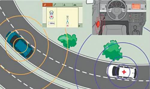
Emergency vehicle notification system
An in-vehicle e-call is generated manually by the vehicle occupant(s), or automatically via activation of in-vehicle sensors after an accident. The e-call carries both voice and data directly to the nearest emergency point (normally a public safety answering point). The voice call enables the vehicle occupant(s) to communicate with the trained e-call operator and simultaneously a minimum set of data—that includes vehicle identification, information about the incident, time of occurrence, precise location and direction in which the vehicle was travelling—is sent to the e-call operator for taking necessary action. In most developed countries, e-call is a standard option for all approved vehicle types.
Road traffic cooperative system
A cooperative system in road traffic means road operators, infrastructure, vehicles, their drivers and other road users cooperate to deliver the most efficient, safe, secure and comfortable journey. The system is based on communication cooperation on the road.
Data available from vehicles is acquired and transmitted to a server for central fusion and processing. This data can be used to detect events such as rain (wiper activity) and congestion (frequent braking activities). The server processes a driving recommendation dedicated to a single or a specific group of drivers, and transmits it wirelessly to the vehicle(s). The goal of a cooperative system is to use and plan communication and sensor infrastructure to test road safety.
Varying speed limits based on road congestion
Experimentation with variable speed limits that change with road congestion and other factors is being pursued. Typically, such speed limits generally deteriorate during poor conditions, rather than improving in good conditions. One example is Britain’s M25 motorway, which circumnavigates London. Variable speed limits combined with automated enforcement result in savings in journey times, smoother-flowing traffic and a fall in the number of accidents.
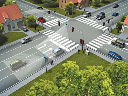
How a basic ITMS works
A basic ITMS assists road authorities in maximising operational performance and reliability. This assistance is across all aspects of the road network. It is important to manage transport problems by integrating technologies, such as car-navigation system, traffic-signal-control system, variable message signs, automatic number plate recognition or speed cameras, and other systems that integrate live data and feedback from multiple sources, such as parking guidance and information systems, weather information, bridge de-icing systems and the like.
Additionally, predictive techniques are used for advanced modelling and comparison with historical baseline data. Based on real-time and historical data, traffic signal cycles are altered on real-time basis, using in-situ sensors or surveillance devices, to respond to changing traffic conditions.
A simple and basic system comprises a traffic-control centre, a traffic information service centre, a cellular mobile communication system and an in-vehicle terminal (GPS tracer), connected with each other via a wireless communication network (satellites or telecom towers). The in-vehicle terminal communicates with the traffic control centre and the traffic information service centre respectively via the cellular mobile communication system (satellites or telecom towers).
The traffic-control centre provides real-time data related to traffic density in each lane to the priority algorithm controller, which is embedded in the smart box connected to traffic lights. The controller processes the data and transmits controlling signals to the smart traffic lights for switching the traffic lights based on traffic density in each lane. Data collected by the traffic-control centre assists law-enforcing agencies by providing real-time information as soon as a stolen vehicle is detected, monitoring carbon emission by vehicles by synchronising to the database of pollution checking central office, providing automatic and real-time information of any accident taking place on highways, integrating an automated digitised system for detecting traffic violations and issuing an online e-challan to vehicle owners, and providing a clear road for smooth movement of traffic during emergency situations.
ITMS in India
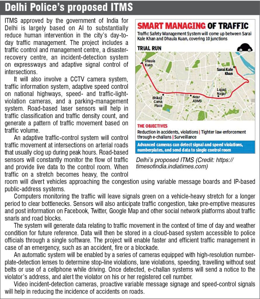
India has started taking steps in planning and initiating ITMS in metro cities, to start with. Delhi Police is currently working on a ` 820-million ITMS project, which covers 220 kilometres of urban roads with 240 signal intersections.
To help improve traffic management a scheme has been implemented in Bengaluru. It is running from a dedicated traffic-management centre from where a team remotely manages the city’s traffic. Nearly 120 cameras at different junctions are remotely monitored. Out of 300 traffic signals, 163 have been connected to the traffic-management centre, most of which are vehicle-activated. This means, if there is a four-second period where no vehicles pass through, the signal automatically turns to red.
As part of Mumbai City Mobility Management project, nearly 700 vehicle-presence-intelligent camera detectors and in-road magnetic loop detectors are under installation at various busy road junctions controlled by traffic signals. Based on the information received from these cameras and in-road magnetic loop detectors, an adaptive traffic-control system alters traffic signal cycles in real time to respond to changing traffic conditions. Once fully-operational, ATCS is expected to cut down waiting time at traffic signals by almost half.
In Chennai, integrated video sensor technology is under trial for intelligent traffic management. One hundred traffic camera sensors have been installed and are operational to detect waiting vehicles at multiple intersections across the city.
Karnataka State Road Transport Corp. is planning to soon implement ITMS for Mysore city under an initiative by World Bank. The scope of implementation consists of design, development, testing, installation, commissioning, training, operations and management of facilities for a period of three years. The project covers 500 buses, 80 bus stops and 10 bus terminals. It will have a vehicle-tracking system, central control station, passenger information management system, communication sub-system, travel demand management, incident and emergency management system, and fleet management system.
The Centre for Development of Advanced Greater Hyderabad has a master plan for implementing ITMS soon with an objective to support optimisation of traffic flow, reduce environmental impact, bring down road accidents, and promote efficiency in traffic and transportation operation and management.
There are further projects in the pipeline across India, such as implementation of ITMS in Indore, Pune, etc.
Conclusion
ITMS is a useful innovation that provides a solution to the existing framework of inadequate traffic management system and its related Web structure (like toll deduction, challan due to over speeding, pollution checking service, VIP/ambulance/fire tender path clearance, vehicle theft and so on).
All these issues are efficiently managed by ITMS to tackle the menace of existing traffic mis-management. Success of the implemented ITMS requires strong backup in terms of policy, legislation, regulation, relevant sector coordination and common action.
ITMS can fail to deliver the expected benefits due to failure not of technology elements, but of some institutional elements. Such systems have been implemented with great success on the fast roads of developed countries like the US, Japan and the UK. Moreover, various researchers are working to make these traffic systems even more advanced. While India has started taking steps in planning and implementation of ITMS, our country still has a long way to go!
Deepak Halan is associate professor at School of Management Sciences, Apeejay Stya University