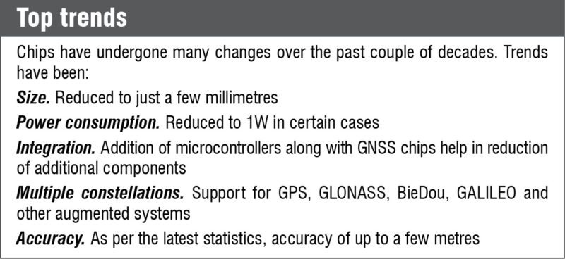
In your smartphone you have a miniature GPS receiver, which has a long story behind it. When the first tracking system became operational in 1995, it was as big as a tablet. Today, we have it integrated into our mobile phones in the form of an integrated circuit. The size of a Global Navigation Satellite System (GNSS) chip is getting smaller with every new launch. It has gone down to 25 mm².
Reduction in chip size has enabled its use with other handheld devices. This article takes a look at some interesting technologies and improvements driving modern GNSS chips, modules and other solutions.
Navigation is a necessity, with uses ranging from a simple human guidance system to a missile tracking system. Majority of such systems involve one or the other kind of GNSS system. GPS, the first guidance system, was set up with the idea of guiding various military operations. But this century has seen the emergence of several other guidance systems, which also together with GPS have helped improve geo-location.
An era of change
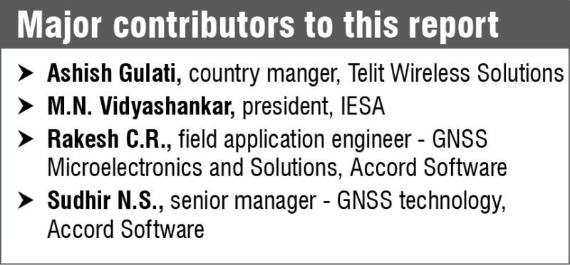
As technology improved over the years, performance of GNSS systems has also improved steadily through availability of multiple constellations of satellites to sync with. Several constellations have gone live and are giving GPS a run for its money. According to Sudhir N.S., senior manager – GNSS technology, Accord Software, “From the usage point of view, people are still slow in taking up multi-constellation systems. GPS is still hogging most of the number of chips sold, but other systems are catching up.”

Globalnaya Navigazionnaya Sputnikovaya Sistema (GLONASS) from Russia, BieDeu from China, GPS Aided GEO Augmented Navigation (GAGAN) from India and Galileo from Europe are some such systems that have improved the tracking. At any given moment we have about 84 operational satellites, solely for the purpose of navigation.
According to Ashish Gulati, country manger, Telit Wireless Solutions, “This means that we are not dependent on the US GPS constellation, and now have the option to go ahead and work with GLONASS, Galileo and others.”
Sudhir says in agreement, “I feel multi-constellations will help in cases where open-sky visibility is not possible. If we were to take vehicle tracking as an example, consider a case of a vehicle tracking unit inside a vehicle. Here, the antenna would have to be embedded since customers today prefer self-containing units with internal antennae and sufficient battery backup to prevent tampering.”
Why multiple constellations is a good thing?
Hidden navigation systems might receive deteriorated signals from satellites, so having multiple constellations will double the number of satellites and better the chances of a good-quality signal being available to users. It could be for anyone, from common people like us to the military stuck in tough terrain.
Rakesh C.R., field application engineer – GNSS Microelectronics and Solutions, Accord Software, states, “In defence application, which is more strategic in nature, people want multi-constellation availability, so that if one service is denied for any reason, they can fall back on other systems. IRNSS is almost available, too. Reliance on IRNSS is going to be much higher in India.”
Design challenges
Once we start reducing the size of the GNSS receiver, we have to keep in mind several factors. For example, when we have several transistors within a space of less than a centimeter, interference from adjoining transmitters becomes an issue at some point. Magnetization, current induced due to magnetization, eddy current and hysteresis are factors that rising from the tracks running around. Requirement of a proper heat-sink is also a major issue inside the chip.
Now, these devices have to be economically viable to make but also be affordable. So cost-reduction measures include low-cost oscillators and low-cost antennae for receivers.
For low-cost antennae, Planar Inverted F Antenna (PIFA) has been a very suitable substitute with very few drawbacks. Single-wafer silicon further allows reduction in chip costs.
Market and manufacturers
“As per the GNSS market report 2014 of European GNSS agency, around the globe 3.6 billion GNSS devices are in use. By 2019, this is forecast to increase to over seven billion,” says M.N. Vidyashankar, president, IESA.
Due to the range of applications, this seems to be a very satisfying number for manufacturing companies. We have GNSS embedded in smart devices, digital cameras, portable equipment, fitness gear and many more.
 Vidyashankar adds, “GNSS is also used in various platforms that are used in automobiles and air navigation systems to display moving maps, information about location, speed, direction and nearby streets. Similarly, heavy equipment employ GNSS in construction, mining and precision agriculture. Cyclists often use GNSS in racing and touring. Spacecraft also use GNSS as a navigational tool.” A very wide market indeed!
Asian companies holding majority of handset revenues dominate the location based services segment. Among others, Furuno, Broadcom, Mediatek, ST Microelectronics, Qualcomm, u-Blox and VectorNav are some giants producing GNSS chips. Navika Electronics is an Indian fabless semiconductor company designing and manufacturing GNSS chip-sets.
Developments in technology
Due to a large market and multiple GNSS chip providers, we have newer and better products coming out on a regular basis. These newer products, either in the form of firmware changes or hardware improvements, help in improving the current guidance systems by achieving certain changes.
Multiple receivers
In a recent release, VN-360 GPS-compass heading-and-position sensor was unveiled by VectorNav Technologies. It is an OEM GPS-compass module that provides an accurate, true North-heading solution for system integrator seeking a reliable alternative to magnetic based sensors. It is a miniature, cost-effective GPS based alternative unaffected by magnetic disturbances and changes to the magnetic environment.
Incorporating two on-board GNSS receivers, VN-360 calculates the relative position between its two GNSS antennae to derive a heading solution. This is an order of magnitude more accurate than a magnetic compass. It supports a variety of GNSS antennae that can be mounted on the host platform with a separation distance anywhere from a few centimeters to several meters.
“VN-360 is like no other product on the market, in that it provides a cost-effective solution for the difficult challenge of obtaining an accurate and reliable heading solution,” stated John Brashear, president, VectorNav Technologies, in a recent press release.
He added, “VectorNav’s GPS-Compass technology marks a turning point in the way we approach heading measurement and will improve the capabilities and performance of a variety of next-generation manned and unmanned systems.”
Fancy an antenna, anyone
Acutime 360 from Trimble is a recently launched product. It is a smart antenna with an integrated multi-GNSS receiver for high-accuracy and precise-timing applications. It includes support for GPS, GLONASS and BeiDou, and is Galileo-ready.
Acutime 360 has a tracking sensitivity of -160dBm and an acquisition sensitivity of -148dBm. It can operate in extreme temperatures (-40°C to +85°C) and hostile radio frequency environments typically encountered at wireless network transmitter sites, with a power input of less than one watt.
Highly minimized
Measuring merely 12.2 mm x 16 mm x 2.4 mm, NEO-M8P is another very small, high-precision module by U-Blox. The GNSS real-time kinematic module is based on GPS and GLONASS satellite based navigation systems. Real-time kinematic algorithms are pre-integrated into the module. As a result, the size and weight are significantly reduced and power consumption is five times lower than existing solutions.
In a recent press release, Daniel Ammann, executive director positioning and co-founder of U-Blox, said, “NEO-M8P lowers the barriers for innovative companies looking to develop equipment that need centimeter-level accuracy in many markets and applications such as unmanned aerial vehicles.”
A wide-range augmented solution
BCM89774, a recent navigation solution launched by Broadcom, provides improved location and positioning while lowering power consumption for in-vehicle applications and reduces bill of materials cost for car makers. Offering simultaneous tri-band reception of all visible GNSS satellites including US GPS, European Galileo, Japanese QZSS, Russian GLONASS, Chinese BDS and global SBAS augmentation systems, Broadcom’s BCM89774 sets itself apart as a wide-band capture radio technology, delivering original equipment manufacturers one of the most accurate solutions available today.
GNSS firmware upgrade
With a firmware upgrade by U-Blox, for its earlier M8 module, U-Blox M8 FW 3.01 now also supports Galileo, in addition to GPS, GLONASS, BeiDou, QZSS and SBAS. It can track up to three constellations concurrently. It makes use of all SBAS and QZSS augmentation systems at the same time.
In addition, with FW 3.01, U-Blox M8 now boasts of BeiDou acquisition sensitivity and adds support to Indian GAGAN augmentation system. According to a recent release, “Security mechanisms have also been embedded in FW 3.01. An anti-spoofing feature detects fake GNSS signals and a message integrity protection system prevents man-in-the-middle attacks. Another security function detects and suppresses jamming. A welcome feature of FW 3.01 is the ten per cent power reduction compared to earlier firmware versions.”

Employment in wearable
All GNSS chip-sets can easily be employed in handheld devices like smartphones, tablets and palmtops. But wearable application requires further miniaturization. Smartwatches have been the talk of town; selling like hot cakes, these essentially are mini computer systems.
With features like receiving and making phone calls, smartwatches have become a scaled-down version of your mobile phone. For these devices, we do not necessarily need accuracy of up to centimeters; a few meters is fine. Hence, GNSS chip-sets supporting a single satellite system is fine when it comes to wearable.
“Asset tracking is an area where we have seen a lot of inquiries. Chips used in these wearable would usually be scaled-down versions of those used in vehicle tracking. In such cases, you could just use a GPS module without additional constellations as these really do not need that kind of accuracy,” says Gulati.
With the boom in wearable, miniaturization has been taken to the next level. Very soon we might have GNSS chip-sets smaller than a nail with tracking accuracy in centimeters. This would give a huge burst to GNSS-aided missile-guidance systems. The irony of such a helpful guidance system is that, it is growing by reducing the size.


