

A number of small satellites equipped with advanced electronic systems have been successfully projected that will be performing a range of scientific measurements and produce valuable information
The European Space Agency (ESA) has launched 42 tiny satellites aboard the Vega rocket, which took off from ESA’s launch site in French Guiana on 2 September 2020 local time. The PICo-Satellite for Atmospheric and Space Science Observations (PICASSO) is one of the launched nanosatellites that carries with itself a state-of-the-art remote sensing technology, developed and built by VTT Technical Research Centre of Finland Ltd. It will allow scientific measurements to be taken in the upper layers of the atmosphere.

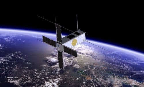
PICASSO is the CubeSat nanosatellite mission of the Royal Belgian Institute for Space Aeronomy (BIRA-IASB), weighing only 3.5 kilograms and carrying two measuring instruments for atmosphere research.
One of its payload, the Visible Spectral Imager for Occultation and Nightglow (VISION), also built by VTT, can perform sun occultation measurements. Another payload, the Sweeping Langmuir Probe (SLP) (developed by BIRA-IASB) can do plasma measurements in the ionosphere.
Delivering quality data
The instruments launched aboard the PICASSO deliver a combination of scientific performance and small size. The mission aims to demonstrate the capabilities of miniaturisation in remote sensing and provide quality data with respect to their costs that can assist high-quality scientific research.
VISION is a tiny spectral imager for gas measurements in the atmosphere. Its camera has the ability to capture the sun’s visible light in narrow wavelength bands (430-800 nm). When the light of the sun passes through the earth’s atmosphere at different heights (at sunset and sunrise), the vertical distribution of ozone in the stratosphere can be measured.
VISION can also determine the temperature profile of the atmosphere by tracking the deformation of the solar image caused due to atmospheric refraction.
“Integrating atmospheric measurement instruments into a satellite the size of a carton of milk is challenging – but the scientific opportunities are massive. In future, instruments like VISION can also be used to measure other gases, such as carbon dioxide and methane,” says Antti Näsilä, Research Team Leader at VTT
“PICASSO VISION uses the spectral range of visible light to study the ozone layer in the stratosphere and mesosphere. Although the ozone layer at a height of 20-30 km is gradually recovering, it is vital to keep monitoring it due to its links to climate change. The satellite instruments that are currently performing similar measurements are already nearing the end of their useful lives, so the launch of PICASSO VISION occurred at an important moment,” says Research Professor Johanna Tamminen from the Finnish Meteorological Institute.
Enhanced data despite harsh conditions
Depending on the ability to withstand the harsh space conditions, it has been estimated that PICASSO will orbit the Earth at an altitude of about 530 kilometres for one to two years and during that period will continue to gather valuable scientific data.
Additionally, the mission will serve to indicate the current research capabilities of CubeSat nanosatellites and provide insightful lessons for the future development of small-scale scientific operations.
PICASSO is an international collaboration project of the European Space Agency (ESA). It is led by the Royal Belgian Institute for Space Aeronomy (BIRA-IASB) and in addition to VTT, other partners include AAC Clyde Space Ltd (United Kingdom) and the Centre Spatial de Liège (Belgium).