
New UWB sensor networks and robot teaming enable sub-meter navigation in signal-dead underground environments, improving coordination, safety, and real-time mapping for disaster response teams.
A new electronics-driven navigation system is reshaping how rescue teams operate in underground disaster zones where conventional connectivity collapses, according to recent research.

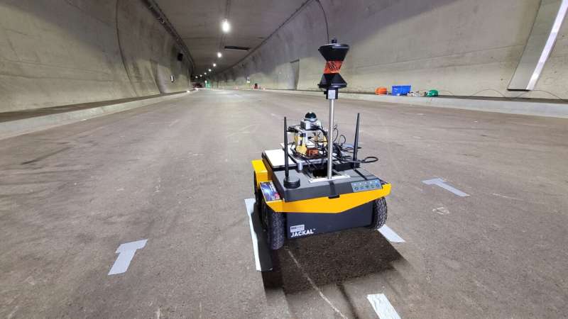
Engineers at Graz University of Technology have developed a system that combines ultra-wideband (UWB) communication, robotic sensing, and wearable electronics to guide responders through tunnels, mines, and collapsed infrastructure—areas typically devoid of GPS, mobile networks, or lighting.
The approach centres on a coordinated “teaming” model between robots and humans. A sensor-equipped robot first enters hazardous zones, using laser scanners, cameras, and motion sensors to build a dynamic digital map of the environment. That data is then relayed through a custom UWB network to human responders following behind.
Rescue personnel carry compact UWB tags and deploy anchor nodes along their path, forming a localised positioning network. This electronic mesh enables real-time tracking of both humans and machines with accuracy better than one meter—even without a direct line of sight.
The system also integrates inertial sensors embedded in responders’ footwear to capture movement patterns such as walking or crawling. AI algorithms analyse this data to maintain positioning accuracy when visibility is poor or when the terrain is obstructed.
A key technical layer is factor graph optimisation, a robotics-derived computation method that continuously refines position estimates by reprocessing past sensor data. This allows the map to evolve dynamically as teams revisit locations, improving reliability during extended missions.
The development reflects a broader push toward resilient underground electronics. Separate research has already demonstrated low-frequency magnetic communication capable of transmitting voice signals up to 100 meters below ground, highlighting growing interest in non-traditional wireless systems for extreme environments.
Early field tests show the system can significantly enhance situational awareness in complex underground scenarios. Researchers are now working to ruggedise the electronics and expand capabilities with aerial drones for additional data capture.
As disasters increasingly involve dense urban infrastructure, such integrated sensing and communication platforms could become essential tools for next-generation emergency response.