

The micro drone has been designed for high accuracy mapping applications such as developing maps and 3D models
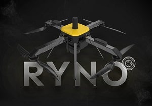 ideaForge, an India-based manufacturer of drones for defence, homeland security and industrial applications, has launched its new drone RYNO, a micro category (<2 kg) survey-grade drone designed and specialized for high accuracy mapping applications. It enables users to perform highly efficient land survey operations to develop accurate maps and 3D models.

RYNO UAV is equipped with an advanced mapping payload and state-of-the-art PPK module for delivering high accuracy up to a centimetre. The drone offers <5 cm Typical X, Y Accuracy at 60 m AGL and <10 cm Typical Z Accuracy at 60 m AGL in real-world conditions. The UAV has a flight time of over 40 minutes and a range of up to 4 km. With a minimum area coverage of 1 sq. km. at 120 m AGL (for UAOP holders in India) per flight, RYNO UAV ensures mapping projects are completed faster.
Compliant With Indian Drone Rules
Being a micro category drone, RYNO UAV has the lowest training requirements as per the civil aviation rules. With its affordability and superior performance, private surveyors and large enterprises across industries such as oil & gas, renewable energy, power generation, mining, manufacturing and construction can produce highly accurate detailed maps and 3D models to obtain operational success in mapping projects. The UAV is also NPNT-ready to ensure compliance with Indian drone regulations.
“We are committed to creating an Atmanirbhar Bharat and building Made-in-India drones for the world. RYNO UAV is our first specialized mapping drone and we are extremely pleased with the fact that SOI has qualified our micro drone for mapping Indian villages. For us, it is the biggest validation of the drone’ capabilities and its ability to perform flawlessly anywhere in the world. We are confident that with RYNO UAV’s competence to deliver superior and reliable results, we have raised the bar in industrial drone technology for mapping applications,” said Ankit Mehta, CEO, ideaForge.

Largescale Mapping Project
ideaForge’s family of survey-grade micro drones meets all the stringent specifications laid down by the Survey of India (SOI), India’s principal mapping agency. It has qualified these survey-grade micro drones for mapping India’s diverse and challenging landscape under India’s Swamitva Yojana, which aims to map over 660,000 villages using indigenously developed MICRO drones.
The results will be used to create high-resolution maps to maintain accurate land records for all the villages that will help settle a large number of ongoing property disputes and make it easier to buy and sell land.
The project is also a pivotal step in establishing India as a drone superpower as it will strengthen the local drone ecosystem and create thousands of jobs in the industry.