


Combines Ultra-wideband (UWB) radio-based communication, accurate floor mapping, TDOA processing and data science computation
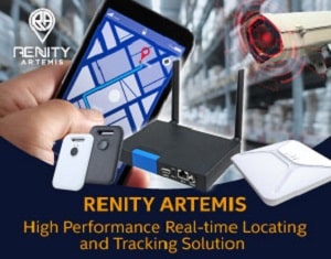 Avalue Technology, an industrial PC solution provider has launched the RENITY ARTEMIS high performance real-time locating and tracking solution, which uses the tracking and locating technology of geographic information GIPS Technology to help customers in various fields improve management efficiency and reduce management costs.
The RENITY ARTEMIS combines the stable and accurate features of UWB wireless communication technology with the TDOA computation, so it has the ability to accurately locate and track up to 30 cm. Moreover, UWB uses 3.1GHz~10.6GHz RF band, no interference with other RF band below 2.4GHz. Besides, the power spectral density (PSD) is lower than natural radio wave noise. A signal is difficult to intercept. Track people and locate assets at any time, so that managers can instantly optimise resource allocation.
Accurate geofencing: Easy to segment restricted area
With floor mapping and TDOA processing, ARTEMIS possesses the ability of an electronic fence. No need to work or arrange on-site, just plan out the scope on the system, then you can use the signal to accurately segment the area and assign authority of entering to each label. In addition to avoiding danger from entering dangerous areas by people without permission, it can also avoid the loss of assets.
Instant notification system: shorten the notification process
Each label is equipped with a button. When a situation needs to be notified to the manager, the holder can press the button to proactively notify the system to request support. The system will immediately pop up notification to remind the manager of incidents. This can shorten the notification process when the situation occurs, improve the management response time and increase management efficiency.
Historical trace analysis, optimize path and production line
ARTEMIS has proprietary software can track every tags’ historical trace and look over the route. Moreover, it can compute historical data and analyse the movements of asset or staff to optimise paths and processes, increasing productivity.
API integration: combine various resources
ARTEMIS integrates with existing software such as registration and inspection systems, as well as with other hardware such as CCTV to visualize the area. This function helps users to more conveniently combine the new system and improve the efficiency of use.
Application and effect in different fields
The functions of RENITY ARTEMIS have suitable applications in various fields. For example, there are thousands of trolleys in a large textile mill. Often the staff will spend a lot of time looking for the designated trolleys, and occasionally the trolleys may be lost. Using the locating system of this solution can quickly find the location of the trolley, greatly reducing the time for the staff to find a trolley.
Segmenting the area of the geofencing can also prevent the vehicle from leaving the restricted area and reduce the probability of loss.
However, when used in hospitals, various clinics and wards can be segmented through geofencing, so that patients will not enter dangerous areas, reducing the risk of danger and reducing the management pressure of medical staff. Also, by integrating the existing system with the notification button through the API, the patient’s status can be visually confirmed through the CCTV when the patient is prevented from issuing an alarm, shortening the process of warning and increasing the response and processing time of medical staff.