Are you a tad scared?
If things like cookies, supply chain tracking and location-based services raised privacy concerns, microsatellites and their imagery services is a prime candidate for raising the public privacy concerns. While it is a matter of concern that somebody might know when a strange car is parked outside your home or when there is a party happening on your terrace, government regulations do attempt to reduce threats to privacy to a certain extent.
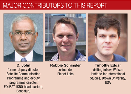
“The privacy risks could be quite profound,” worries Edgar of Brown University, but goes on to elaborate on the checks and balances that might address citizens’ privacy concerns, “When the United States government uses classified imagery for domestic purposes, it has a strict legal process for approving such uses. First, lawyers analyse whether the imagery might constitute a search that would require a warrant (for example, infrared imagery that might reveal private activities inside a private building or imagery that can peer over a high wall inside a private space). Second, lawyers look into whether the imagery crosses any other legal boundaries. Without strict oversight, close satellite monitoring could pose all of the same risks as surveillance drones, or other spy devices that might invade people’s private space or monitor their activities. For example, a frequently-updated satellite image might show at what time my car is parked at my home, church or office, and this could be correlated with other data to fill in a picture of my daily activities.”
Asked about strict regulatory control to avoid invasion to peoples’ right to privacy, he remarks that, “This is a new area and so the answer is, unfortunately, no; not at the moment. Regulators have focused more on issues such as whether private aircrafts or spacecrafts pose any safety risks, either to other aircraft or to people on the ground, and haven’t focused on privacy issues. That may be changing, but the government is often slow to catch up with transformational technological change.”

Schingler, however, assures us that, “Space is a regulated industry, and we have to go through the proper channels and protocols to ensure compliance. We have in-house expertise dedicated to working with regulators. Plus, we have mitigated privacy risks by having satellite imagery with a resolution of 3-5 metres. This consideration was built into our models from the very beginning, when we set up our company. At this resolution, we can see a tree canopy, but not a person.” Skybox Imaging, however, has been allowed a closer resolution of one metre.
John guides us about the regulatory authorities in India: “Building and putting a satellite to use by a private company involves getting security clearance from the appropriate ministry of the government of India—for remote sensing, launching the satellite and frequency clearance for the use of the satellite. For these, one should approach the director, Public Relations Office, ISRO Headquarters, for advice. For frequency clearance, one must approach the WPC wing of the Department of Telecommunications.”
The age of small sats
Electronics is all around us today, and trend-watchers are declaring that the era of the Internet of Things has begun. Well, it looks like ‘things’ includes satellites too. We will soon have a network of connected ‘everything,’ from traffic signals and dishwashers, to industrial systems and freight cars, and satellites too. The day will come when we will no longer have to worry about outdated maps in our navigator device, or about missing a friend by a minute. Maps will be updated within minutes if there is a road diversion or even in case of a traffic jam! Insurance companies can review satellite images to see when a fire actually broke out; while an agriculturalist can use them to study meteorological changes and predict crop yields.
Truly, small satellites mean endless opportunities for governments, small and big businesses, and even for individuals.
Opportunities for businesses arise not just from the imagery data at their disposal, but also from the components and applications they could sell to this nascent industry. John says that remote sensing cameras and miniature spacecraft control components, such as reaction wheels, are just a few of the opportunities for electronics companies.
Small satellites show a lot of promise, but of course, like any emerging technology, they ought to be supported by the necessary standards, protocols and regulatory guidelines to ensure interoperability and fair competition, and to overcome privacy nightmares.
The author is a technically-qualified freelance writer, editor and hands-on mom based in Chennai


